Bunta's Initial B, Touring Japan by motorcycle
2016 Arimine Lake Touring
Jan
Since October I have been busy with both public and private, so I could not renew my blog quite well so I restarted from last year’s Touring.
We toured to Arimine Lake at the foot of Tateyama mountain range of Toyama prefecture we went last October.
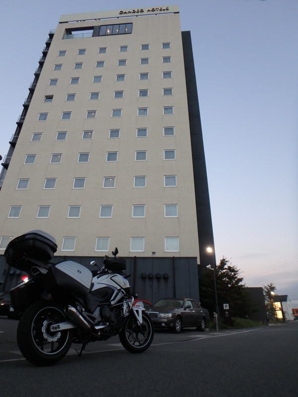
Departed in the evening on 14th October. I plan to run around the mountain in Nagano from early morning 15th, staying at the Candeo Hotel in Chino.

Leaving the hotel at 5 o’clock in the early morning. Temperatures are 0 ° C, no matter how it is in October! ! Cold. .
The exposed part becomes painful and it hurts.
It still runs through a dim busy road, goes through Takafu ~ Gonbei tunnel and goes through the prefectural road 463 – 441 which runs through Kiso Fukushima, Kaida Kogen’s “prefectural highway 361” and can run while watching Ontakeyama.

This road is a fun road that runs narrow and steadily bendy,
After going out to Route 41, we aim for Mattari and Takayama.

I am giving up on entering the old city landscape with a tremendous crowd, only photos. .
Today ‘s purpose is around Arimine Lake which runs for the first time.
From Takayama, go out on the prefectural highway No. 89 to the national highway 471 and run the prefectural highway No. 484 which will lead to the existed forest road finally.
A surprisingly wide and comfortable running prefectural road 484, when arriving at the top the tunnel with the gate!

Here is Mt. Furin Road. Even if you call forest roads, you pay for this road.
Going through the tunnel will enter Toyama Prefecture.
I ran into the lakeside running bendy and I came across such a magnificent scenery.

This is the Tateyama mountain range rising to the other side! There is a Kurobe lake opposite that mountain ~

Arrived at Kameya Onsen of today’s inn, descending from Arimine forest road.
After all the hot spring after arriving at the touring is the best (^ ^ ♪
On 16th, today I will go to see the famous name Falls boasting the largest difference in Japan.
Despite getting information, although the feelings started early, the gates were not open to the descent ~

Climb at a stroke at the same time as opening the gate, parking lot at the beginning!
It is a famous name Falls which came to see when nobody climbed the road for about 15 minutes.

The power of the falling 350 m is fluffy! I bathe a lot of splashes on the wind blowing by the waterfall momentum although it is far.
It was cold, but we enjoyed taking a great view of the monopoly over time.
Go down the famous name Falls and go up another lake by another route “Would you say it is a left route?”
There was a road width on this route, and it was able to run with good rhythm
This time it is a magnificent view of Morinoko lake in the morning.

I got coffee and Mattari at a place where popularity is low (^ ^ ♪

Coffee you drink in a superb view and delicious air is also exceptional.
It is still earlier, so I decided to leave the old road of Awa Pass for the first time in the way.
I ran into this mountain running while remembering that it was so narrow.

The descending from here becomes narrower further.
There used to be no Awa tunnel in the past, so I left here from the passenger car to the sightseeing bus.
It took more than 2 hours to get out of the crowding period ~
That should be that! It’s too narrow that the bus can not bend at once.
From here we go running from Azusako to Kiso at the prefectural highway No. 26 but SS and ZRX 1200 will follow from behind.
Well ~ ~ ~ ~ This is NC 750, if you run comfortably and be fucked up, you should give up with haste.
Such feeling felt comfortably to run through the pass, but it is okay Well I told the pass was over without giving way. “When I raise the pace, I disappeared from the rear-view mirror”
It is the last break here because we enjoyed a lot from Enrya ~ High Toward ~ Stop Pass and enjoying it.


I enjoyed the scenery of the fine Suwa and got a cake.
From here, I ran at all times the route, last time I came home at Yanagisawa Pass.
I accidentally found the route on the Google map, but it was quite a good route.
How about you, too?
http://zrx-drz.at.webry.info/201701/article_2.html